Also on Google Earth
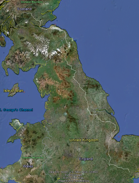
In August 2012 I cycled from Wormingford in Essex to Lochearnhead in Perthshire, Scotland. This was a distance of about 600 miles. I used a standard hybrid bicycle with a two-wheeled trailer behind, containing camping equipment for use where possible on gliding club airfields en route, but also three commercial camp sites. I reported my progress on Twitter as I went along (http://www.twitter.com/wamsanderson), and the planned and actual route and waypoint files are below.
I supported Parkinson's UK, the Alzheimer's Society, and Sustrans. I chose Virgin Money Giving (http://uk.virginmoneygiving.com/AndySanderson) because their commission is much lower than for-profit giving sites and the charities will therefore get more of your money. Through Virgin Money Giving, you can sponsor me and donations will be quickly processed and passed to charities. Virgin Money Giving is a not-for-profit organisation and will claim gift aid on a charity's behalf where the donor is eligible for this. I really appreciate all your support and thank you for any donations. If you wish to donate directly, please let me know.
The "Total raised including Gift Aid" amount on the Virgin Money Giving site is incorrect as it does not include Gift Aid on the offline donations. To date (24th November 2012) the true "Total raised including Gift Aid" amount is Ł2304.15
Except in towns where they are rather more accurate, the waypoints in the files given below are only accurate to within about 50m but should give an excellent idea of the route I plan to take. To fly a route using Google Earth, click on the KML link below, find it in Google Earth in Places|Temporary Places, expand it with the white arrowhead, click the day, then the "Play Tour" button (three blue squares) below.
There is no MIME type on the server for GPS Exchange Format GPX files. I can't imagine why anyone would want them anyway, but if you do, please download them as text and then save as GPX.
| Day | Day/Date (or soon after) | Start | End | Mileage | Google Earth | GPX Exchange | |
| 1 | Tue 7th Aug | Wormingford (Essex & Suffolk GC) | Ridgewell (Essex GC) | 19.92 | Day1.kml | Day1.txt | |
| 2 | Wed 8th Aug | Ridgewell (Essex GC) | Gransden Lodge (Cambridge GC) | 38.04 | Day2.kml | Day2.txt | |
| 3 | Thu 9th Aug | Gransden Lodge (Cambridge GC) | Crowland (Peterborough & Spalding GC) | 43.13 | Day3.kml | Day3.txt | |
| 4 | Fri 10th Aug | Crowland (Peterborough & Spalding GC) | Strubby (Lincolnshire GC) | 52.43 | Day4.kml | Day4.txt | |
| 5 | Sat 11th Aug | Strubby (Lincolnshire GC) | Kirton in Lindsey (Trent Valley GC) | 37.07 | Day5.kml | Day5.txt | |
| 6 | Sun 12th Aug | Kirton in Lindsey (Trent Valley GC) | Burn (Burn GC) | 38.70 | Day6.kml | Day6.txt | |
| 7 | Mon 13th Aug | Burn (Burn GC) | Sutton Bank (Yorkshire GC) | 41.17 | Day7.kml | Day7.txt | |
| 8 | Tue 14th Aug | Sutton Bank (Yorkshire GC) | Evenwood | 43.15 | Day8.kml | Day8.txt | |
| 9 | Wed 15th Aug | Evenwood | Chopwell (Northumbria GC) | 35.49 | Day9.kml | Day9.txt | |
| 10 | Thu 16th Aug | Chopwell (Northumbria GC) | Raylees Common | 27.77 | Day10.kml | Day10.txt | |
| 11 | Fri 17th Aug | Raylees Common | Milfield (Borders GC) | 41.75 | Day11.kml | Day11.txt | |
| 12 | Sat 18th Aug | Milfield (Borders GC) | Dunbar | 46.59 | Day12.kml | Day12.txt | |
| 13 | Sun 19th Aug | Dunbar | Edinburgh | 37.99 | Day13.kml | Day13.txt | |
| 14 | Mon 20th Aug | Edinburgh | Portmoak (Scottish GC) | 26.38 | Day14.kml | Day14.txt | |
| 15 | Tue 21st Aug | Portmoak (Scottish GC) | Lochearnhead | 50.77 | Day15.kml | Day15.txt | |
| TOTAL | 580.35 | All.kml | All.txt |
The task is finished - achieved KML files from FollowMee are here:
| Date | Google Earth |
| 07/08/12 | 20120807.kml |
| 08/08/12 | 20120808.kml |
| 09/08/12 | 20120809.kml |
| 10/08/12 | 20120810.kml |
| 11/08/12 | 20120811.kml |
| 12/08/12 | 20120812.kml |
| 13/08/12 | 20120813.kml |
| 14/08/12 | 20120814.kml |
| 15/08/12 | 20120815.kml |
| 16/08/12 | 20120816.kml |
| 17/08/12 | 20120817.kml |
| 18/08/12 | 20120818.kml |
| 19/08/12 | 20120819.kml |
| 20/08/12 | 20120820.kml |
| 21/08/12 | 20120821.kml |
| 22/08/12 | 20120822.kml |
| 23/08/12 | 20120823.kml |
Charity cycle ride from Essex to central Scotland, via various gliding sites
Back in February of 2012, I decided that I was going to resign from the teaching job I had held for 9 years, with a view to having more self-directed fun and spending much more time on various projects that had been waiting in the wings for a while. Despite the long school holidays, there was never enough time to do anything but the essentials of what I needed to do outside work each year, and furthermore, I am told, people only live once. I now do some private tuition, and work on these other projects.
So, at last not having to be back in time for the start of a new academic year in September, to improve my fitness and also to see many places that I had never been before, I decided to cycle to Scotland, on a bog-standard hybrid bicycle. Initially, I hadn't even considered doing it for charity, because it was something I wanted to do purely for myself, but I was slowly persuaded that there were people who wanted to donate towards good causes, and that this would be useful excuse to wring money out of them. So I set up a Virgin Money Giving web page and with the tireless assistance of my mother Barbara, who approached her many friends and relatives, we finally managed to achieve the grand total of approximately Ł2000, in favour of the Alzheimer's Society and Parkinson's UK. Huge thanks are due to all my sponsors.
From the outset of my plans, I alerted the club members at Essex & Suffolk Gliding Club, and about a week before departure, one of our members, Paul Johnson, confirmed that he would accompany me for the first half of the journey, as far as Sutton Bank. After that, he would have to return to work, and I would carry on. I think that he was quite pleased that I had done most of the navigational planning before we set out, so the responsibility was on me not to get lost. As it turned out, I wasn't 100% successful, but it was mostly OK. It was, in fact, surprisingly fascinating just to do to the planning. I spent quite a few hours in front of my computer with the Ordnance Survey website open, and also Google Earth, and a couple of other mapping applications showing things such as Sustrans cycle routes, as it was my intention to stay off the main roads as much as possible, for safety. Generally, using the cycle paths turned out to be a good idea, though not always. Using Google Earth's "Streetview" facility led to many sensations of "deja vu" during the trip.
I towed a two-wheeled bicycle trailer, which when loaded with equipment totalled 45kg, of which 15kg was the trailer itself. In hindsight, that made things quite a bit more difficult, but on the positive side it meant that I could take all the luxuries I wanted, as well as the necessities. Sticking out of the top of the trailer cover was a tall fibreglass pole with a large bright orange home-made windsock on the top, all very "glider pilot". Generally, other road users saw this and avoided me well, though for some reason drivers of German cars (BMWs and Audis) occasionally showed themselves to be rather isolated from reality. The extra drag from the windsock did not seem to be a problem at normal speeds.
Day 1: Tuesday 7th August, Wormingford to Ridgewell
So, after final weather checks, and a certain amount of faffing about with the equipment, we set off mid-afternoon, heading for Ridgewell (Essex GC), a distance of only 20 miles, as I had thought it would be a very good idea to ease gently into the task. We left the main gate of Essex and Suffolk GC at Wormingford, and headed down Sandy Hill towards Bures. This instantly proved to be one of the fastest parts of the entire journey, as we picked up speeds in excess of 30mph within the first half mile, quite interesting with a fully loaded trailer. Through Bures and Sudbury, the journey was more or less flat then a gentle climb leading to Ridgewell fairly late in the day. The most interesting part of the trip was the cycle path along the old railway line around Sudbury, which was rather rather muddy through trees and somewhat like a scene out of Lord of the Rings. At Ridgewell, we were met by one of their long-standing members, Dave Jones, who very kindly lent us the bunkhouse to sleep. We left most of our kit at the club and cycled into Ridgewell village itself to have a very nice evening in the White Horse, where the food was very inexpensive and good, and as they had just finished a beer festival, we helped them finish the beer. Despite this we managed to find the airfield later in the dark to get some sleep.
Day 2: Wednesday 8th August, Ridgewell to Gransden Lodge
The next day, we set off early for Gransden Lodge (Cambridge GC), a longer distance of 38 miles, and accomplished this without too much drama. The weather was still fine and the ground undulating. I would like to thank ESGC club member Colin Downes, who knows the roads there well, for suggesting we go round the Gog Magog hills through Sawston rather than over them, getting us off the main road and saving us a 200 foot climb. I stopped off briefly in Great Shelford to take a photograph of a house once occupied by my friend in Scotland, Neil Gregory (who coincidentally lives in Lochearnhead, the final destination of this trip), and we were delighted to see a man in flowing robes, some kind of a monk I think, walking along Hinton Way with a wide grin and a cheery hello. The main difficulty of the day, if it could even be called that, was that north west of Grantchester the cycle path turned into more or less a walk along the edge of a farmer's field, and then down a narrow country path. Shortly afterwards however, the high point of the day was finding a small shop in Toft that sold South African food, so we invested in a kilogram of boerewors (farmer's sausage), with a view to munching it for supper, and some biltong to chew on at any suitable time. It was quite a long day and we arrived at Gransden Lodge just before 6pm. My travelling companion Paul managed to convince Joanne at Gransden that we were fully deserving of a bunk house for the night. Cambridge Gliding Club is the first club I joined back in the early 1980s, and I did all my ab-initio training there, mostly when the club was at Duxford. The first flight I ever had was in Bluebell, their venerable T21. That evening we went to the Crown and Cushion in Great Gransden, and once again somehow managed to find our way back in the dark.
Day 3: Thursday 9th August, Gransden Lodge to Crowland
The third day we headed for Crowland, along mostly flat roads over the southern fenland, and by pure chance the B1040 goes all the way from Great Gransden to right outside the gate at Crowland. Unfortunately, I had not managed to raise any response from Crowland about staying there overnight, but we decided to press on regardless. When we got there there was some model flyers operating on the airfield, and once they realised what we were doing, they let us into the clubhouse where we had access to cooking facilities and the bar. The next day some gliding club members arrived and were quite surprised to find a row of empty bottles of Spitfire lined up on the bar and random strangers on the sofas, kit strewn everywhere.
Day 4: Friday 10th August, Crowland to Strubby
Once breakfasted, we struck off again across the fens, but on this day the wind was more against us. We made quite slow progress across the fens, but we were privileged to find a lengthy diversion that we did not have to take because the contractors allowed us to use their newly-resurfaced road, and we believe that we were the first members of the public to use the the surface, which was jet black, glassy smooth and fast. But generally, because there are very few trees in the fens, the wind delayed us and progress was quite slow, so we arrived at Strubby (Lincolnshire GC) quite late. Also, somewhere in the fens, we had taken a wrong turn which made us climb up a steep hill into Candlesby, only to lose all the height again straight away on the way out of the village. That was my first navigational error. Glider pilots will recognise this as like a massive thermal followed by strong sink... rather pointless and irritating. When we finally got to Strubby airfield, the old sentry box at the gate looked as though it needed some care and attention, and may well have dated from the war for all I know, but we also found some gliders, a winch, and other obvious signs of a gliding club. We were not permitted to camp on the airfield, but it is owned by the same people who run the local leisure park (Woodthorpe Hall), so we had a great place nearby to stop for the night. Many thanks to Janet Stubbs for allowing us to camp at no charge, and it is indeed an excellent site with an on-site pub for food in the evening.
Day 5: Saturday 11th August, Strubby to Kirton in Lindsey
On day five we set off for Kirton in Lindsey (Trent Valley GC), via Louth and Market Rasen. This entailed climbing up the Lincolnshire wolds, which was quite hard going, but we then benefited from a fantastic fast ride down the other side into North Willingham, achieving the highest speeds of the trip at very nearly 40 miles an hour. At one point I thought I was going to break the speed limit as we entered the village. The weather remained good, and Kirton in Lindsey was quite easy to find. Upon arrival we made use of the facilities and enjoyed meeting some club members. We cycled into Kirton for supplies, and camped on the airfield. Without the trailer behind me, on the way into the town and back, I noticed that my bike seemed turbocharged.
Day 6: Sunday 12th August, Kirton in Lindsey to Burn
Day six was a long day, to Burn (Burn GC). It took us through Scunthorpe, which rather alarmed me when I planned the trip, but I was quite surprised at how attractive and peaceful-looking parts of the town are. We then turned west, out over the Levels, once more on a very flat road towards Thorne, which I have to say does look very sadly faded. I had already seen this on Google Earth Streetview, so it did not come as too much of a surprise. Apparently, much of the coal industry around this area has now gone, and it does show. The rest of the day's cycling was steady and flat, and we arrived at Burn while flying was still going on, via the Trans Pennine Trail. We saw three of the local coal-fired power stations in the distance. Club member Terry Bassett very kindly lent us his caravan, which we slept in after a quiz night at the local pub. I think we got the wooden spoon. Also, Chris Cooper kindly managed to get some local press coverage for us.
Day 7: Monday 13th August, Burn to Sutton Bank
Day seven was one of the more interesting and varied days on the road. We set off from Burn to Selby still on the Trans Pennine Trail, but in Selby the path degenerated into little more than a sheep track alongside the river. I was concerned that if this track was going to go along the river all the way to York, we would not arrive before midnight, but as soon as we got into Barlby, the cycle path turned into a veritable cyclists' motorway, gradually descending towards York, with the wind a good ten knots from behind and very few of those annoying tree root bumps to worry about in the path surface. After Riccall, we also found an amazing scale model of the solar system, unusually with the planet diameters to the same scale as the distances between them, i.e. properly done, unlike those pictures in books which can never be to scale. Research indicates that the model's scale is 575,872,239 to 1, enabling us to cycle at a speed approximately equivalent to ten times the speed of light. Initially we passed Pluto on a small plinth, with some signs and distances that I didn't immediately understand, and I didn't fully realise what we were seeing until we reached the next model, of the planet Neptune. Now I could see that we were travelling inwards from the outer solar system, and that the distances to the adjacent planets, and some real distances at that scale, were marked on signposts at each model. The outer planets were about the size of small footballs and separated by at least two kilometres each. Between Saturn and Jupiter, when the old railway track passed over the Ouse via the Naburn Bridge, we found an amazing artwork, the "Fisher of Dreams" by local artist Pete Rogers, which is a huge wire-frame model of someone fishing off the edge of the bridge (in fact the Fisher had caught a small train, representative of the Flying Scotsman that used to run on the old railway track), and behind them a bicycle onto which a dog is cocking his leg. As we got further in towards York, planetary things began to happen much more quickly and as we passed Mars, the planets were more like marbles or ball bearings, separated by barely a couple of hundred metres. At the very end of the cycle track was a metres-wide silver ball representing the Sun, again to the correct scale. I couldn't help thinking (with my teacher hat on once again) what a wonderful resource this would be for Astronomy lessons, as most people have no idea of the relative scale of the solar system, let alone anything bigger. Beyond the model of the Sun, we went into York, but in a burst of enthusiasm my navigation failed and we crossed the river Ouse a little too early and ended up somehow in a pedestrian precinct with hundreds if not thousands of people milling all around. It became impossible to cycle and as we were deciding that this was not the best place to be, a woman sprung out of the crowd and helpfully suggested that to avoid conflict with the local constabulary, we should cross back over the river and take the next bridge along, which as it happened turned out to be the correct route. We had to make an interesting weave through the grounds of a castle park back onto the cycle track north, heading for Sutton Bank (Yorkshire GC). The land in the Vale of York is remarkably flat, but we knew that this was not going to last... and it was already getting quite late as we approached the foothills of the North York Moors. Although it is possible to go around and up the back of Sutton Bank, that would be an extra 8 miles or so, and I had decided that we should bite the bullet and go up the south face of the ridge, via the forest path. What I did not fully realise was that the gradient there is up to 25% in places, so steep that traction on my boots was beginning to fail, and therefore almost impossible to make progress. However, I had anticipated some of the problem, and had developed a method of pulling the trailer up by tying a piece of old dyneema (which we use for launching gliders at ESGC) around an old army belt around my waist, then a couple of bungee cords, and some strong string (a tent guy rope with an adjuster for length) tied to the trailer, all this operated by leaning forwards as far as possible and tiptoeing forwards very slowly to pull the trailer up the hill, with the trailer pushing the bicycle. The bicycle handlebars had been locked in place by a couple of adjustable strings running back to the seat post. With this device, and with my chin on the bell, I inched my way up. Paul had less weight on his bicycle so he made better progress up to the top, but without that home-made device I would still be there, a lonely skeleton at the bottom of the hill. Once again, we were made very welcome by the people at the club.
Day 8: Tuesday 14th August, Sutton Bank to Evenwood
On the eighth day, we began by cycling down the front of Sutton Bank. We had been made acutely aware by members of YGC that if we got it wrong the likelihood is that we would either fall off the side of the mountain or crash onto the face of the cliff, and in either case would probably be rendered dead. Cycling to the top of the face of the hill it soon became mightily apparent that they were not kidding. With 45kg of trailer behind me, I wondered if my brakes would hold out, and on the way down whether if I pulled any harder on the brakes the cables might break or slip, and then I would be in serious trouble. But in the event, neither of us were killed on the way down, though I think I got through a third of a set of brake pads, front and rear. At Sutton-under-Whitestonecliffe, Paul headed off in a different direction to catch a train back home from Thirsk. It was quite strange heading off north on my own, towards Evenwood, near Bishop Auckland, where Billy Cunningham had kindly let me stay the night at Craggwood camp site without charge. The road through Northallerton and Darlington was surprisingly flat for north Yorkshire, though right at the end there were quite a few stings in the tail. I remember sending a text saying that Evenwood was neither particularly wooded nor was it in any sense even. The reason for choosing the site at Evenwood was because there was no gliding club within a sensible day's range of Sutton Bank to the north, at the speeds I could do when cycling with the trailer.
Day 9: Wednesday 15th August, Evenwood to Castleside
On day nine, my intention was to arrive at Currock Hill (Northumbria GC), but despite a number of admittedly fairly feeble attempts I had not been able to contact them either prior to departure nor during that particular day. That particular day proved to be a complete nightmare, undoubtedly the worst of the trip. The forecast was for an active cold front coming in from the south west, and I had chosen a route which was almost entirely on cycle tracks. I set off through Bishop Auckland but unfortunately they seem only to have half finished the place, with lots of roadworks and vague or missing signs, leading to the rapid onset of confusion and as far as I could tell the disappearance of the published cycle track at a dead end in the middle of a housing estate. In an attempt to get back on track I somehow ended up on the bypass, going round the entire town anticlockwise almost 270°, and finally finding a way out over the Newton Cap viaduct to the north onto the Brandon to Bishop Auckland cycle track towards Durham. This old railway path was not the best cycle track I had seen, being mainly cinders. I made slow progress and by the time I was approaching Durham it was already raining steadily. I plugged on regardless and the rain became heavier and slowly soaked me right through. The only opportunities to check my location on my mobile phone GPS map were under dark railway bridges, usually in the middle of forests, reminding me a lot of when we first set out going round Sudbury on the first day. The old railway track path no longer went over the roads that intersected it, as most of the bridges had been dismantled, so at each intersection I had to climb down steep ravines to cross the road, then laboriously climb up the other side. This happened quite a lot and was very tiring. As the weather got worse, at some point along the route I must have missed a right turn in the gloom and rain, and ended up heading west instead of north. I vividly remember crossing what turned out to be the Hownsgill Viaduct, which was completely unfamiliar from the planning stages, and looking over the edge at the tops of trees 175 feet below (apparently it is a favourite suicide location), the wind was blowing, the rain falling, and at that point I figured I may have gone wrong. In order to find a point I could identify on the map, and a dry place to look at my GPS map, I pressed on a bit and soon burst out on to some sort of road. I could see a bigger main road about a third of a mile away (which turned out to be the A68) so I headed for it having almost abandoned hope of getting to Currock Hill, and instead I thought that I could probably find a place to stay in Corbridge which is quite nearby to the north. However, once I got on to the A68 it immediately became apparent that with the visibility being completely appalling, and darkness falling, it wasn't really the best place to be. I managed to make it into Castleside, and by this time it was getting quite scary. By the end of the village, I had decided that it was too dangerous to go on any more, so I went into the last pub in the village, the Manor House Inn, apologised to the landlord for making a pool of rain on his carpet, and asked him if he knew anywhere to stay. He said that I had just passed a couple of bed and breakfasts, and having seen another nice inviting pub further up the hill I decided that the best thing to do would be to abort the day's destination and stay there that night. This turned out to be an extremely good decision. I found the Castleneuk B&B and introduced myself to Peter, the owner. I put my bicycle and trailer in his garden shed. Apparently, the drains down the A68 through Castleside aren't quite up to the job, and at this point it was raining cats, dogs, and cows, the worst weather in quite a while, I was told. I can vividly remember standing in the shed watching what was effectively a river coming down the A68, turning left past the shed and disappearing through the garden. On the way back to the front door, a lorry happened to come past just as I reached the corner of the house, and it threw over me a wave of about two bucketloads of water, which got me square in the face. I was soaking wet anyway so I actually found it quite entertaining, and went back inside to get sorted out. Within half an hour, I had had a nice hot shower and had put my gear out to dry. I then went up into the town wearing full wet weather gear, and sat in the Smelter's Arms with an extremely welcome hot meal and a couple of pints. My administration consisted of looking carefully at what I could do the next day. Originally, I had intended to visit the mother of my aforementioned friend Neil, and my route from Currock Hill would have taken me through Corbridge where she lives and then back out north to a wild camp in the forest at Raylees Common, which is basically in the middle of nowhere in the border country. It would only have have been 28 miles, but by this time the countryside was indeed getting rather lumpy. A close look at the map told me that if I was prepared to do approximately 70 miles (by far longer than any day previously done) I could make it all the way to Milfield (Borders GC) and save myself a full day. As I left the pub, the rain had stopped and I think the stars may even have been out. That night, I slept very well.
Day 10: Thursday 16th August, Castleside to Milfield
So, the next day I set off with renewed vigour, with my underwear and one pair of trousers waving in the breeze tied onto the trailer to dry. This was also going to be a difficult day, for different reasons. The initial climb into Consett was followed immediately by another fairly terrifying and brake-defying descent into the bottom of the valley heading north, down the old Roman road past Corbridge to the west, and then cross country to Belsay and Morpeth. One of the best sights and happiest moments of the day was cresting a hill and finding the Whittle Dene series of reservoirs laid out in front of me, that supply Newcastle and Gateshead with drinking water. The weather was fine, and I was sorely tempted to stop for a swim, but it probably was prohibited and anyway I was short of time. The other side of Belsay, the road from Whalton down to Morpeth was fantastic, a perfect cycling surface going gently downhill all the way, mile after mile, covered at quite a high speed, then under the A1 down into Morpeth. Morpeth appears to be a place where somebody years ago found a large natural hole in the planet, and decided to build a town in it. Although it was good fun belting downhill into Morpeth it was fairly miserable climbing back up out of it and rejoining the A1 north of the town, and then it was mildly scary travelling a few hundred metres on the A1 itself before heading off to the left on the A697 in the direction of Coldstream. At this point the road started going more or less up towards the sky, then down and up, and so on. Climbing out of the Coquet valley was particularly hard work, and took forever. By this time, I had contacted Ken Marston (the grounds manager at Borders GC) with an estimate for my arrival time, and got instructions get to the airfield, but I misunderstood them slightly and missed the turning. I managed instead to find the turning that I had originally planned to take but it was marked as unavailable except to residents, so not wishing to risk a wasted mile or more I elected to use the hammer and tongs route of going almost up to Milfield around the north of the airfield. By the time I arrived it was almost 9.30pm and just about to get quite dark. I met up with Ken, dumped most of my stuff at the airfield, and we went to the pub. The whole day was eleven and a half hours of cycling, with only half an hour for lunch just north of Morpeth. Strangely, I didn't feel that tired, so obviously my stamina had improved quite a lot, or maybe I was simply too tired to notice any more. Having gained a day by missing out on the forest camp, with a confident forecast for continuous rain, and thoroughly impressed by Borders GC's facilities, I decided to stay there for 24 hours to regroup, and not least to dry out some of my still wet clothing, do some washing and to generally laze about in good company. Borders GC is certainly a club that I would like to fly at in future, and they believe with some good reason that they are one of the best wave sites in the UK. Indeed when I left the next day heading north, somebody achieved 23,000 feet. So, I rested on the Friday.
Day 11: Saturday 18th August, Milfield to Dunbar
Borders GC to the Belhaven Bay camp site at Dunbar (where Jake the Park Warden let me stay for no charge) was a relatively pleasant day, with good weather, and I had sorted out my stuff properly and put a new battery in my cycle computer, though annoyingly it defaulted back to kilometres and I could not access the instructions to revert it. I was still in the border country and was by now getting quite used to going up long hills by settling back into first gear and plodding away. After a nasty but short climb past Norham Castle, there was a long and gentle descent towards the bridge over the River Tweed half way between Berwick and Coldstream. Unexpectedly here, the river had undercut the high south river bank, and most of the road had taken off down the hill. However, it was possible to get past on the remainder of the road, and I crossed what they call the "chain bridge" and at last found myself in Scotland. I had lunch north of Ayton and briefly went south east on the A1 for about 50 metres before turning north towards what I assumed from the map would be a reasonable country road. It rapidly turned into a really difficult forest track, the worst you can imagine, basically two muddy and wet ruts surrounded by thick vegetation. It was not even possible to cycle on this track, and it took considerable time walking to make progress to the north west, towards Cairncross where I hoped that I could either go left or right out of my predicament. As it happened, the road which carried on from Cairncross, whilst appearing much the same on the map as the forest track, turned into a perfect cycling surface which carried on north west towards Dunbar. I climbed up over the moors past the new wind farm, and soon saw Torness nuclear power station and even Bass Rock in the distance, before coming down a five mile long continuous and fast descent. The weather was perfect and it was one of the best sights of the entire trip. From that point, getting into Dunbar was relatively routine, past the amazing LaFarge cement plant. I would also have liked to stop at Siccar Point, to see the unconformity in the rocks where James Hutton said that he was looking into the "abyss of time", but for me, time was a bit too short. Once I had found the camp site and pitched my tent, I went back through the town to a quiet pub (not easy to find in Scotland on a Saturday evening) to do my administration for the next day.
Day 12: Sunday 19th August, Dunbar to Edinburgh
Next day, the basic idea was to go west to Edinburgh and navigate the cycle paths through the city to the Caravan Club camp site at Silverknowes (where CC organiser Rosie Eaton was letting me stay at no charge), but at East Linton I bumped into some local cyclists who told me that the coast road was quite good for cycling, so I abandoned my rather complex and lumpy route around Arthur's Seat (which almost certainly would have got me lost, despite sheaves of maps), and re-planned to go west by instinct, hugging the coast. I passed Hailes Castle, that seemed totally in the wrong place down in a valley to be defendable from attack, and then ended up on the cycle track to Haddington, where someone had unhelpfully dumped some bitumen and shingle to "repair" the track. All it did was cake my bike and trailer in black tar. I went through Cockenzie and Port Seton, Prestonpans, and then Musselburgh (cutting a few corners from my plan as being a Sunday the main road was quiet) finding to my surprise that Edinburgh has quite a nice sandy beach, at Portobello. I kept going west along the coast road through the dock area at Leith to the camp site at Silverknowes. The day had proved to be very easy indeed, and mostly flat, so I arrived very early and had plenty of time to sort myself out for penultimate day.
Day 13: Monday 20th August, Edinburgh to Portmoak
From Edinburgh to Portmoak, things went slightly wrong. Heading west towards the Forth Road Bridge was fine and the cycle path was much better than expected and very well marked through Dalmeny, leading towards the bridge. Going over the bridge was very interesting because of the crosswind and the lorries making the bridge wobble significantly. However, by pure inattention, I then managed to make a mistake by simply continuing to follow the cycle path, so instead of ending up in Cowdenbeath, I ended up in the eastern part of Dunfermline. I had to resort to my GPS map and cross east over the M90 again, then somehow ended up on the A92 just after it had ceased to be a motorway. Most of the drivers on it appeared unaware of the end of the motorway, so I considered this to be fairly hazardous place to be, as traffic was going past at about 80mph. Luckily, weather conditions were very good, but I still pedalled like crazy for about three miles to try to get off the road as quickly as possible. Eventually I got into Cowdenbeath itself, which was a relief. Once I had re-established the correct route, I headed north parallel to the M90 on minor roads through Kelty, turning right past Vane Farm and left towards Portmoak. Having worked at Portmoak for four and a half months as a professional instructor in 2003, I already knew quite a few people there, and it was a great pleasure to see them once again. I planned to stay there a day, which happened to coincide with some bad weather, but in the evening of my day off I was invited for one or two whiskies. In the intervening time since 2003, I must have forgotten quite how to drink whisky (i.e. not too much) because I woke the next day feeling fairly queasy. So the one day I was planning to spend at Portmoak turned into two, which as it happened wasn't a bad thing anyway, because the bad weather was continuing a bit longer than forecast.
Day 14: Thursday 23rd August, Portmoak to Lochearnhead
On the final day to Lochearnhead, I was not too keen on the prospect of going over the Ochils towards the Earn valley, but as it happened there is quite a nice low road through the mountains, and by this time I was fairly fit for climbing hills. Despite some early drizzle, the weather gradually improved, and coming off the north side of the Ochils into Gleneagles was a real pleasure. They had the Johnnie Walker golf championships on at the time, so I steamed past all the corporate tents wondering who in their right mind would spend so much time out on a windy field. I headed north, having lunch and drying off the drizzle in a very well tended and peaceful graveyard just before Muthill, then went north to Crieff. John Horne, a club member at Wormingford, had grown up in the area and told me of a shortcut along the river just beyond the glassware factory, but it was fairly inconspicuous so I missed it and went up into the town, then west to Comrie, St. Fillans and eventually the final destination, Lochearnhead. The last part of the journey was almost flat up the Earn valley and around the north side of the loch. I spent a few days in and around Lochearnhead, cycling up the mountainside track through the Glenogle estate towards Killin, and around Loch Earn, then, having had more or less enough exercise for a while, hired a car from Sterling to come back down south.
Overall, this trip was a fabulous experience, the general type of which I would recommend to everyone. It was about 600 miles. Physically, I lost a significant amount of flab despite having many pies and pints on the way. Mentally, I am not sure what effect it had... I suppose it showed me what I could do with determination, though to be fair anyone could do this sort of thing - it just takes hours of pedalling. The planning worked well enough, I didn't get killed, and I saw some fascinating sights and went to many unusual and interesting places.
I learned some things... firstly that the road surface quality can be significantly different from place to place, whatever the type of road. It is not the case that small roads are bad and big roads are good - in fact there seems to be no correlation at all between the size of road and quality of road surface, though in general roads in towns are poor, with uneven surfaces, sunken drain covers, badly engineered patches, and so on. Up north, they seem to leave small circular holes in the road at intervals, about the size of a Scotch pie, and I still have no idea what they are for. Some have grass growing out of them. The worst surfaces are cobblestones, which are thankfully rare in the UK. If the surface is very worn it can be quite smooth, but if partly worn there are random vertical bumps perhaps up to a centimetre tall, that produce a violent vibration that can rearrange the contents of your trailer and your jaw. Road surface wear seems to be worse under trees, presumably because of more regular water and ice breaking it up. Also, cycle paths are not necessarily better than going on the main road, as their surfaces can be anything from glassy smooth to sheep track impossible, and their width can be narrow, but they do tend to be a lot quieter for obvious reasons. A major point about doing this kind of trip is to keep dry, and the weather was largely very kind to us in August. I also learned that dragging a 45kg trailer behind me was not really the most sensible thing to do. The trailer was undetectable on the flat, pushed me down hills, but going uphill was a very different story. So, it has been sold on eBay (remarkably achieving almost its purchase price), along with the high pressure slick tyres I put on for the journey (knobbly and flabby BMX tyres are useless due to the high rolling resistance). In place of the trailer and tent, I have now purchased a new rucksack and a Hennessy hammock, which I recently used for a week's cycling in Portugal in all types of weather, and it is proving to be a much more sensible way of sleeping overnight. It sounds mad, but once you've tried a proper hammock, you'll never go back to a tent... not only is it light and easy to set up, it's also possible to sleep anywhere where you can find two poles or trees, irrespective of the ground surface. So now, when I go cycling, all I need is my rucksack, and a roll mat and sleeping bag in my big 59 litre Ortlieb waterproof bag, i.e. the sort of things that can be thrown onto a plane to anywhere, and easily bungeed to the top of the rear pannier frame.
One thing is for sure, that I will be off again on another cycling trip soon - perhaps less well planned now that the hammock means I can very easily find a place to stay the night, on the fly and almost at the last minute. It's the best way to travel and to see any country. Another thing is that I was constantly reminded during this trip of the generous nature of glider pilots and people in general - we met some hugely helpful people on the way up north. It was great to visit so many gliding clubs, and I hope that I can call in to any or maybe all of them to do some flying some time. I was planning to mention by name everyone who sponsored me and helped us along the way, but there are far too many, and this report is too long already. Sponsors are listed on my Twitter feed and Virgin Money Giving page, and hopefully it will suffice to say thanks to them and to everyone else who helped by way of providing accommodation or any other assistance. It was all hugely appreciated and made the experience something that both I and Paul will remember fondly. This report has been directed at a wide variety of audiences, and every minute of the trip had different things to see and remember, so all I have done is try to pick out some of the main points. Planned and achieved daily routes can be found at www.andysanderson.me.uk.
Finally, really, the only way to properly experience this kind of trip is to do one yourself. If I can do it, so can you.